Hackberry Canyon
Description
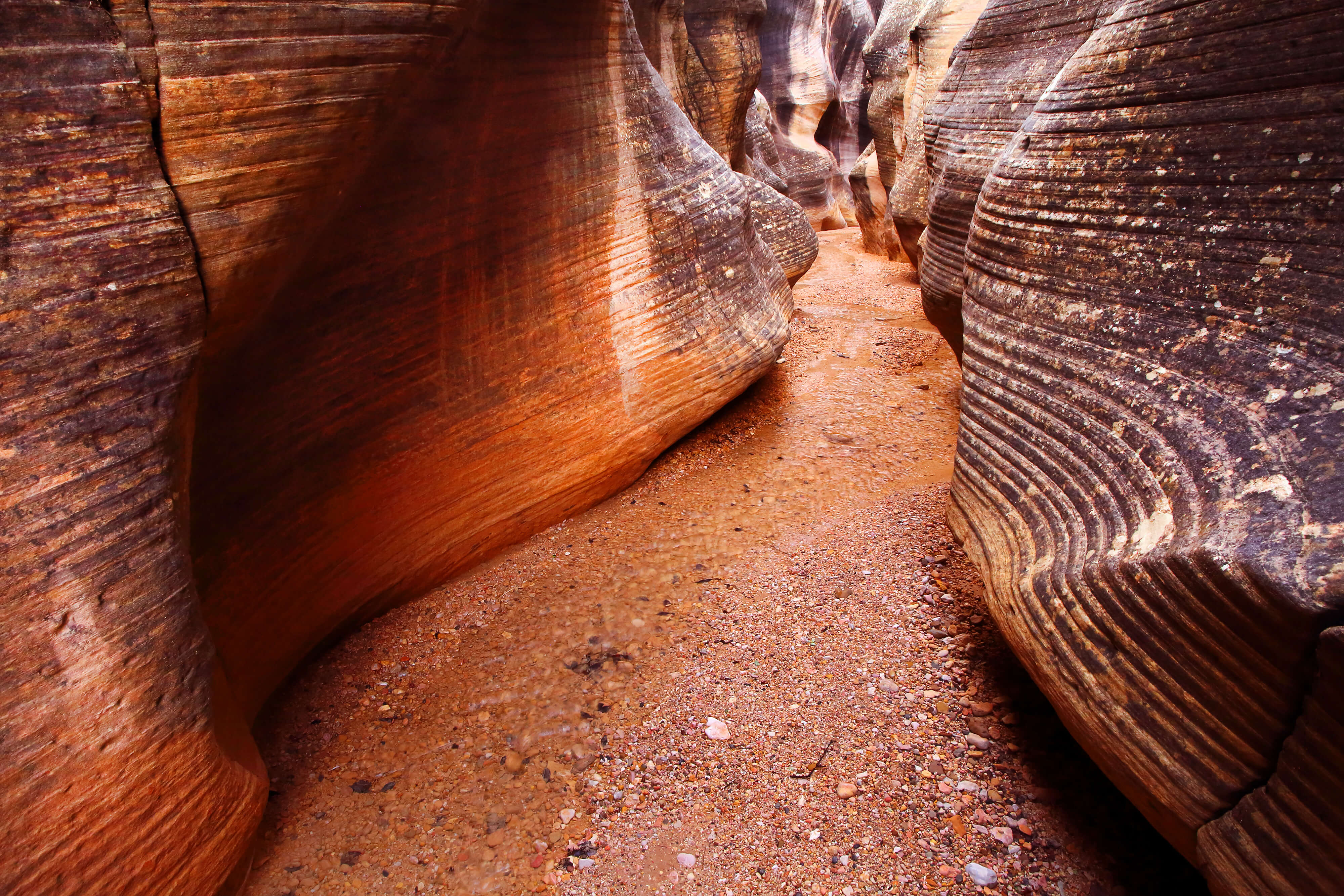
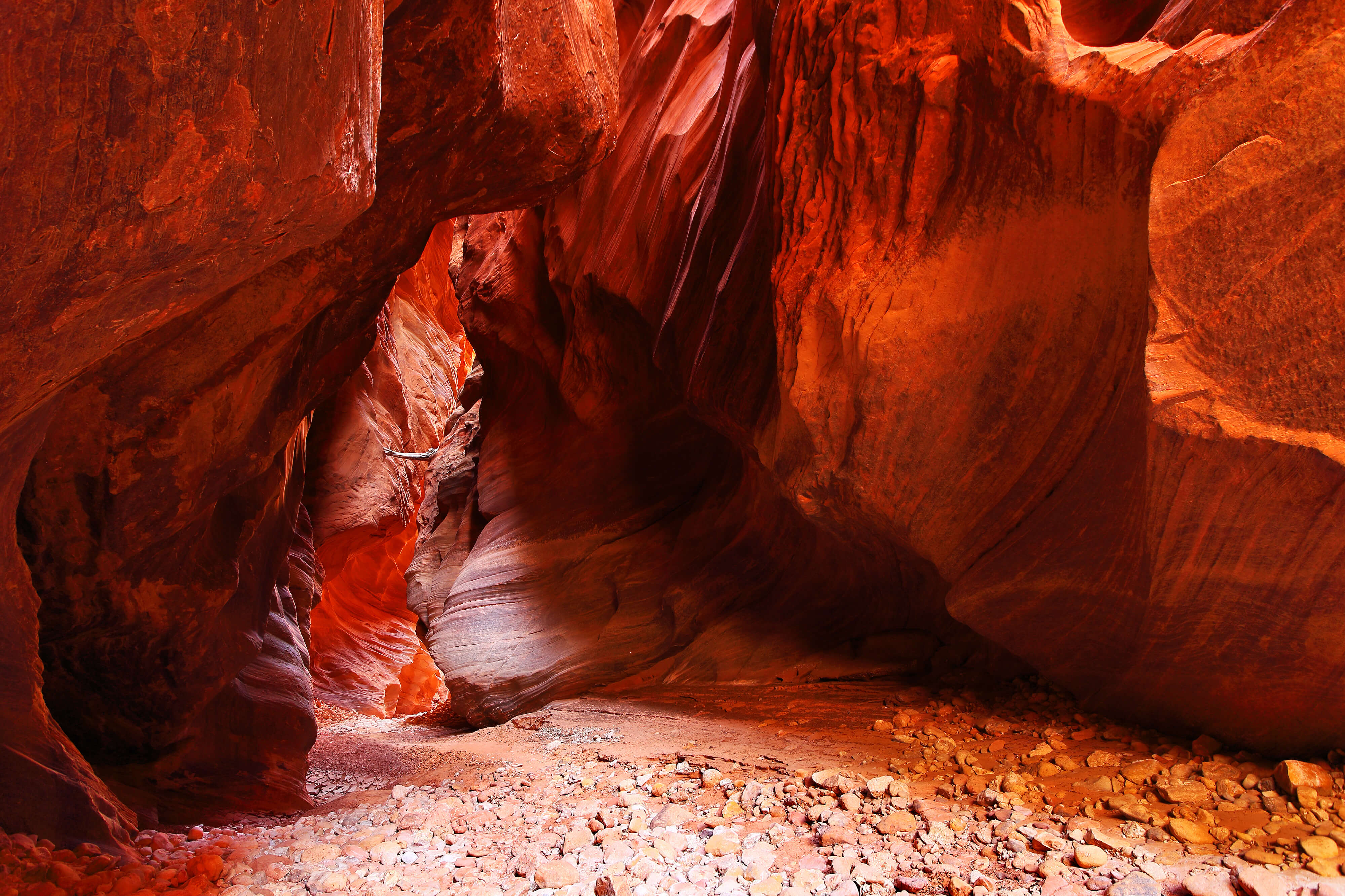
Hackberry Canyon offers a diverse array of backcountry experiences. The upper canyon consists of sandstone cliffs and a broad, sandy wash; it’s both impassive and austere. There’s no water until Hackberry Creek emerges from a spring 10 or 11 miles from the trailhead. From there, cottonwoods begin to spring up across sandy alluvial benches. The shallow stream ripples quietly across a flat bed of fine sand, bracketed on each side by willow thickets. The canyon widens as it cuts through the colorful Moenave and Chinle formations. The final two miles cut between soaring cliffs of Navajo sandstone before joining with Cottonwood Canyon. This section is cool, lush, and inviting.

A lone tree clings to the rocks and sand in the narrows of Hackberry Canyon.

Hackberry Creek runs through a remote part of the Grand Staircase–Escalante National Monument. From its broad upper reaches, the canyon funnels down to a spectacular segment of narrows before joining Cottonwood Canyon.
Hackberry Canyon serves up adventure for just about any taste or schedule. Entering from the bottom, the narrows and lower canyon offer an easy but rewarding dayhike. Lower Hackberry Canyon is one of the more popular hikes accessible from Cottonwood Canyon Road. About two miles from the trailhead, after exiting the narrows, a small boulder with dinosaur tracks lies just to the side of the trail. For a relatively short, 3 – 4 hour hike this serves as a good point to turn around. Be warned though–this part of the canyon is idyllic and it will tempt you to stay.
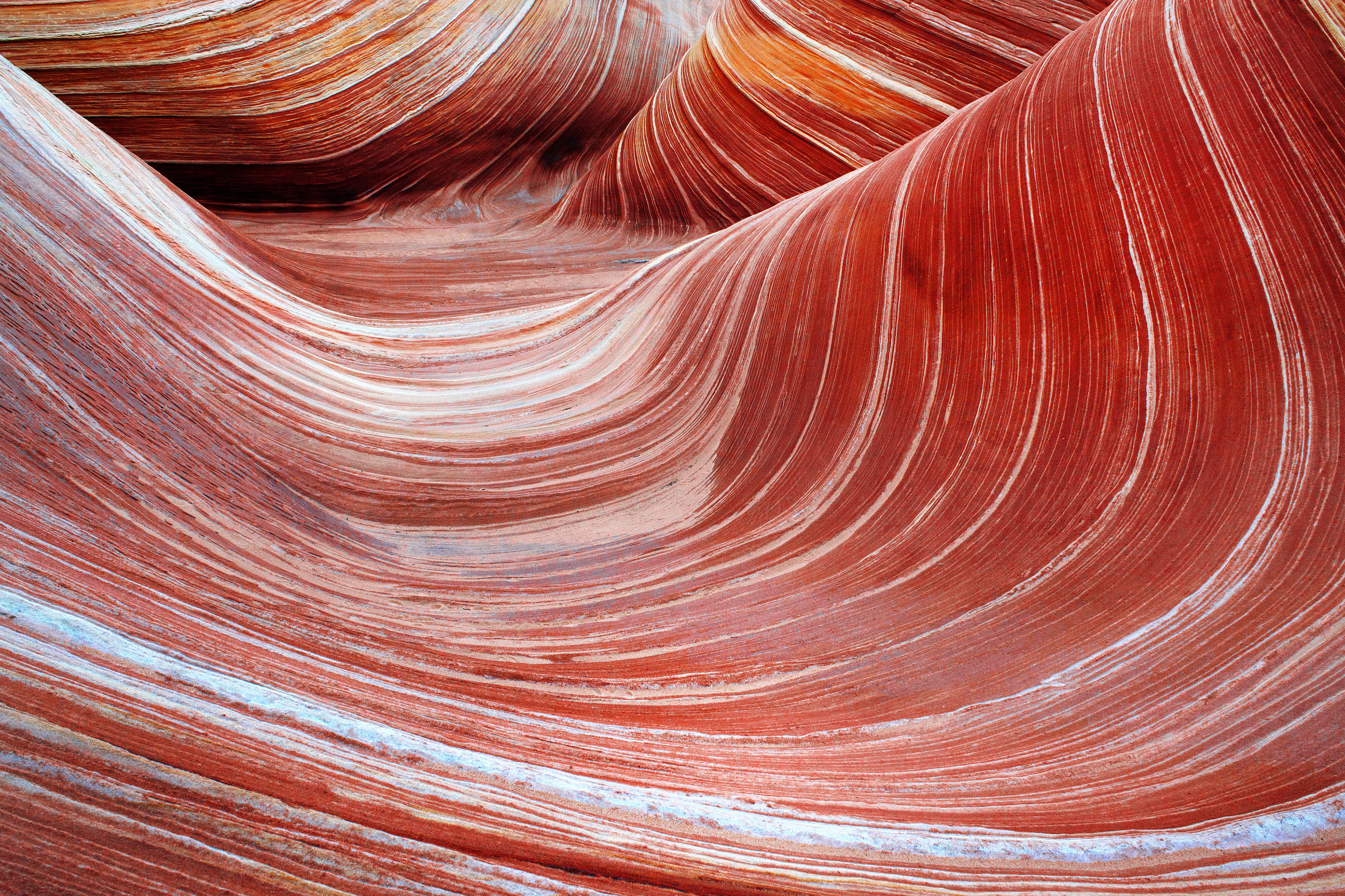
The entire canyon can be traversed one-way in two or three days, depending on pace. For the full experience, start at Round Valley Draw and basecamp in Hackberry Canyon, visiting numerous side-canyons along the way. Worthwhile side-trips include Booker Canyon, Stone Donkey Canyon, and Sam Pollock Arch. While the lower canyon is popular, the middle and upper canyon receive few visitors. If you’re hiking the entire canyon from the top, bring plenty of water for the first day. Find out if the stream is running in the lower canyon. Upon reaching the stream, dense vegetation lines the banks. Often the easiest place to walk is in the center of the sandy stream bed. Bring wading shoes for the lower canyon; the stream is seldom more than an inch or two deep, but you’ll be walking in it for a good part of the hike.
Getting There (Lower Hackberry)
From Kanab, drive east on Highway 89. After crossing the Paria River, the BLM Paria Contact and Information Center will be on the right. Three miles east of the BLM Center, between mileposts 17-18, Cottonwood Canyon Road heads north from Highway 89. The road is well-marked. The parking area for Hackberry Canyon is on the west side of the road, 14.4 miles from Highway 89. This serves as the trailhead for both Lower Hackberry Canyon and Yellow Rock. Road conditions can vary significantly. Often it is well-graded and dry. Sometimes it can be quite washboarded. The roadbed is made of deep, dusty clay and is impassable when wet.

Dinosaur tracks, embossed in a sandstone block, offer a small window into Utah’s ancient past.
From the parking area, walk to the west. A footpath immediately drops into Cottonwood Creek below. Find a cairned path through the willows on the far side of the creek bed. The Hackberry Canyon narrows begin about 1/4 mile to the west. If the creek is flowing, any effort to keep shoes dry is wasted energy. Walking in the sandy creek is the easiest path, and quite refreshing. Bring wading shoes or go barefoot. After about 3/4 mile, a large rock tower will come into view. Overall the narrows are about 1 1/4 miles long, then the cliffs retreat and expose widening, colorful valley. Sandy, cottonwood-covered benches rise above the creek bed.
After another 3/4 mile, look for a talus slope above the left bank of the creek. the slope rises above a sandy, boulder-strewn bench. This bench is where the dinosaur tracks can be found. The boulder in question is fairly small (about 2 feet wide, 5 feet long, and 2 feet high) but bears several obvious footprints along the top.
Getting There (Upper Hackberry)
The road to Round Valley Draw branches off of Cottonwood Canyon Road about halfway between Kodachrome Basin State Park and Grosvenor Arch (FR 422). Look for a sign for Round Valley Draw on the south side of Cottonwood Canyon Road. Turn onto FR 422 and follow it south. Drive about 2 miles to a parking spot and trail register.
From the parking area, walk down the wide rocky wash. After about one mile, a sandstone shelf appears. Keep moving and you’ll find the slot of Round Valley Draw. A short down-climb is required to work your way into the narrow canyon. At the bottom, simply head down the canyon. You may encounter boulders—remember that the canyon can change with every flood. Round Valley Draw is deep and narrow, with undulating sculpted walls. The canyon widens before joining Hackberry Canyon.